Between 2012 and 2013, students from the University of Tehran conducted various mapping projects aimed at documenting the (un)famous Taksim square with new tools, to generate new perspectives and new visions of this space. The objectives of this program, entitled Topographical Practices, was both to explore how to experience in, with and through a site and to generate new definitions of what this square means in the city space, based on unusual yet relevant lenses: quiet users (homeless), emotional responses (agoraphobia), etc.
Their approach, which is truly aims at re-presenting the city from below, echoes the criticism of traditional mapmaking voiced by Alishan Senel in Performative Urbanism. By omitting spatial boundaries and simplifying complexities, many cartographic practices fail to “[accept] one’s point of view as partial, embodied and situated”. This reflects the deep connexion between mapmaking and power in the city, where maps are both the image and the vector of unequal access to certain spaces in the city. We’ve explored in this post about the Paris attacks of November, maps also contribute to the collective imaginary by shaping historical sense and being the actual generators of lieux de mémoire.
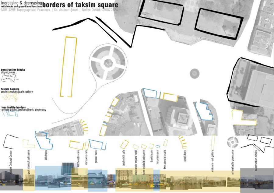
This project, by Nefize Ostürk, explores the different types of barriers found on Taksim square. Onto the satellite image, she adds information about temporary elements –construction blocks, which are closed to the public and force pedestrians into using a narrow passage at the Northwest corner. These construction sites were crucial in determining the student’s experience of the square, both as a walker and an observer, yet may never be acknowledged in any map about Taksim.
A difference is also made between different types of borders –fusible and less fusible ones, where the distinction is based on the ease of access and the restrictions to enter the space such as a heavy door. Yet the student omits to mention that this is a very personal map: a marginalized user, such as a homeless person, would have a completely different map of the square, where most of the “less fusible” borders would transform into forbidden bounds, for instance.
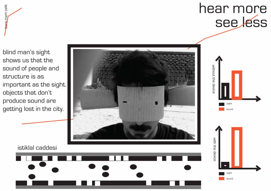
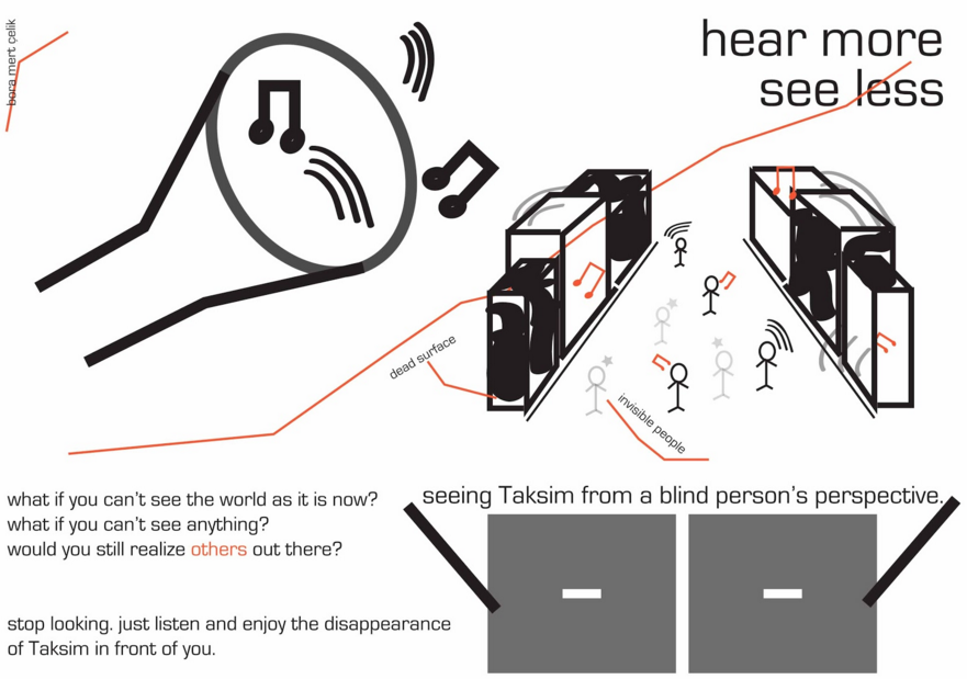
Other projects sought to emphasise the unique and subjective aspect of one’s experience of Taksim. One, for instance, realised by Bora Mert Celik, aimed at creating a device that would enable the user to have a “blind man’s sight”, that is, improved hearing and a long stick as the main way to orient themselves around the square.
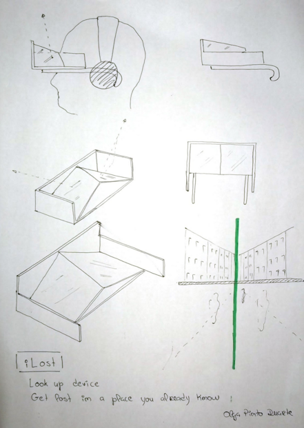
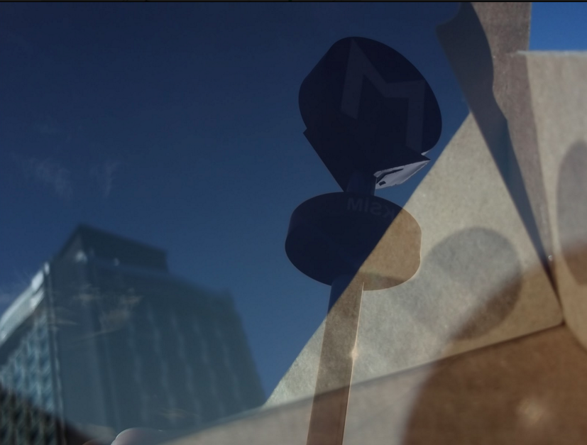
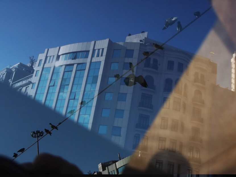
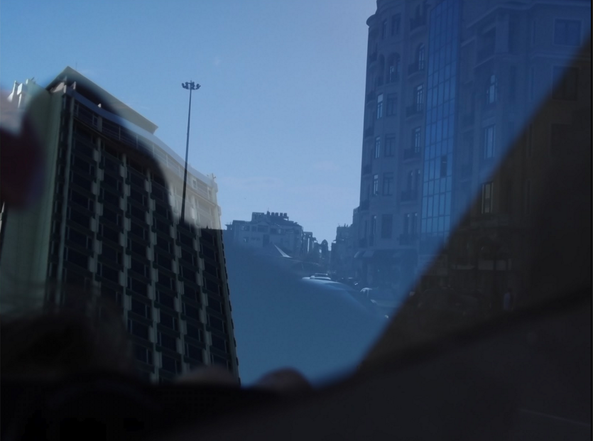
Overall, while the scope and reach of Taksim Topographical Practices remains limited, the work of the students shows a deep interest in reconsidering the implications of traditional cartography, and provides creative means of revealing phenomena which might otherwise never become pictured, mapped or transcribed in any way. In the spirit of the flaneur’s derive, and as a great way to enjoy the city in a different perspective, Olga Pinto Duarte also created a device to “get lost to discover Taksim”: